Photo: ANTARA/HO-PVMBG
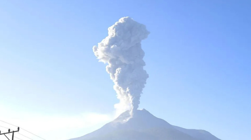
LABUAN BAJO, 18 February (BelTA - ANTARA) - Mount Lewotobi Laki-laki in
East Flores District, East Nusa Tenggara (NTT), experienced three
significant eruptions on Monday (February 17).
Based on information from the Center for Volcanology and Geological Disaster Mitigation (PVMBG) of the Geological Agency, these eruptions were recorded at 15:58, 16:22, and 23:43 local time.
During the initial eruption, the ash column's height was 900 meters above the peak or around 2,484 meters above sea level. The ash column was observed to be gray, with thick intensity, drifting towards the northeast.
According to the statement, the eruption was captured on a seismogram, showing a maximum amplitude of 14.5 mm and lasting around one minute and 42 seconds.
Meanwhile, during the second eruption, the ash column was observed to rise to 500 meters above the peak or around 2,084 meters above sea level. The ash plume appeared gray and thick, moving towards the north and northeast.
This eruption was recorded on a seismogram, with a maximum amplitude of 5.9 mm and lasting approximately one minute 18 seconds.
In the third eruption, the ash column height was 400 meters above the peak or around 1,984 meters above sea level. The ash column was recorded to be gray, with thick intensity, leaning towards the north and northeast.
This eruption was recorded on a seismogram with a maximum amplitude of 3.7 mm and lasted approximately 50 seconds.
Currently, Mount Lewotobi Laki-laki is classified at Status Level IV (Alert).


