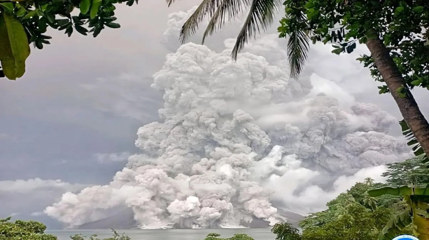
JAKARTA, 30 April (BelTA - ANTARA) - The Volcanological Survey of
Indonesia (PVMBG) recorded that Mount Ruang in North Sulawesi erupted on
Tuesday, spewing volcanic ash up to five kilometers (km) high from its
crater.
PVMBG Head Hendra Gunawan stated that the eruption occurred at 8:35 a.m. Central Indonesia Time (WITA), with a gray ash column heading toward the east and south.
“The eruption was accompanied by hot clouds moving in all directions," he noted in a report received in Jakarta on Tuesday.
On Tuesday, April 30, 2024, at 1:30 a.m. WITA, the PVMBG raised the status of Mount Ruang, from level 3 (alert) to level 4 (caution), in line with the increase in volcanic and seismic activities on the volcano.
The PVMBG urged residents located around the volcano to not enter areas within a six-km radius of the center of Mount Ruang's active crater.
Meanwhile, residents in Tagulandang Island, especially those living near the coast, are urged to stay vigilant against volcanic stones, hot clouds, and a potential tsunami due to eruption material entering the sea or the collapse of the volcano into the sea.
The number of earthquakes recorded through seismic stations on April 29, 2024, was 15 avalanche earthquakes, 237 shallow volcanic earthquakes, 425 deep volcanic earthquakes, 25 local tectonic earthquakes, and six distant tectonic earthquakes.
Meanwhile, several earthquakes, including six eruption earthquakes and 2,057 deep volcanic earthquakes, were recorded on April 1-28, 2024.
Mount Ruang is a stratovolcano that has a peak height of 725 meters above sea level and formed its own island separate from the other islands.
The PVMBG is conducting visual and instrumental observations of Mount Ruang from the Volcano Observation Post located in Tulusan Village, Tagulandang Sub-district, Sitaro Islands District, North Sulawesi.


