MINSK, 26 April (BelTA) – Belarus and Russia will jointly carry out research projects in the area of geodesy and cartography, the press service of the State Property Committee of Belarus told BelTA.
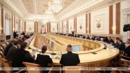
A Belarusian-Russian working group met in Minsk on 26 April to discuss topics of promising joint R&D projects in the area of geodesy and cartography. Among other things the sides discussed scientific and technical approaches to creating information and cartographic products for Belarus and Russia. The creation of domestic software for balancing satellite coverage and ways to increase automation levels in deciphering space images of the Earth surface were also mentioned. The development of conceptual requirements for space cartographic solutions was also discussed. Belarus and Russia intend to work out coordinated proposals on creating a medium-size purpose-built topographic camera for unmanned aerial vehicles.
The Belarusian-Russian working group was established in line the decision the State Property Committee of Belarus and the Federal Service for State Registration, Cadaster and Cartography (Rosreestr) made in Sochi on 25-26 October 2017. The working group is co-chaired by Sergei Zabagonsky, Director of the topographic and geodesic enterprise Belgeodesy, and Leonard Yablonsky, Deputy Director of the Federal R&D Center for Geodesy, Cartography, and Spatial Data Infrastructure.


