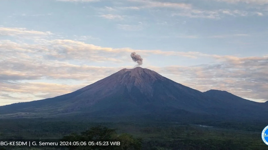
LUMAJANG, 6 May (BelTA - ANTARA) - Mount Semeru, which reaches 3,676
meters above sea level on the border of Lumajang and Malang districts,
East Java, experienced another eruption spewing volcanic ash on Monday.
"Mount Semeru erupted again on Monday (May 6) at 5:43 a.m. local time, spewing ash of around 700 meters above the peak, or around 4,376 meters above sea level," officer of the Mount Semeru Observation Post, Mukdas Sofian, noted in a written statement received here on Monday.
The eruption of the highest mountain on the island of Java spewed volcanic ash that was observed to be white-gray in color with thick intensity, and the ash headed towards the southwest and west.
"The eruption of Mount Semeru was recorded on a seismograph, with a maximum amplitude of 22 mm and a duration of 108 seconds," he said.
Mount Semeru is still on alert, or level III status. The Center for Volcanology and Geological Disaster Mitigation (PVMBG) has urged the public to not conduct any activities in the southeast sector along the Besuk Kobokan River or as far as 13 km from the peak of Mount Semeru or the eruption centre.
Beyond this distance, the public is advised to not carry out activities within 500 meters of the river bank along Besuk Kobokan, as they can be potentially affected by hot clouds and lava flows up to 17 km from the peak.


